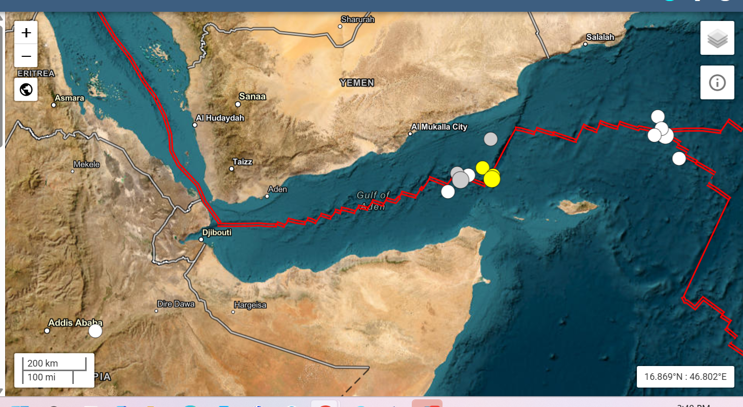
Monitoring networks, including the USGS and EMSC, have recorded localized earthquake swarms along the oceanic fracture systems of the Gulf of Aden.(Periodic Post 2)
Situated between the southern coast of Yemen (Arabian Plate) and northern Somalia/Somaliland (Somali Plate), the Gulf of Aden represents an active divergent plate boundary forming the eastern limb of the Afar Triple Junction.
Geological & Structural Context
- Divergent Spreading Axis: The central Sheba Ridge acts as an active oceanic rift opening at approximately 1.5–2.0 cm/year.
- Transform Fault Systems: High-angle transform faults (such as the Alula-Fartak Trench system) slice across the oceanic crust, driving shallow strike-slip earthquakes (≤ 10 km depth).
- Volcano-Tectonic Activity: Basaltic magmatism along the ridge axis frequently generates persistent micro-seismic swarms.
Recent Earthquake Activity Log
Below are recent reviewed shallow earthquakes recorded along the central oceanic ridge and transform structures:
| Date | Mag (Mw) | Depth | Epicenter / Tectonic Zone |
|---|---|---|---|
| Sep 29, 2026 | 4.4 | 10 km | 246 km SE of Mukalla, Yemen / 186 km NNE of Caluula, Somalia |
| Sep 28, 2026 | 4.8 | 10 km | 286 km SE of Mukalla (Eastern Gulf of Aden transform) |
| Sep 26, 2026 | 5.2 | 10 km | Central Gulf of Aden Spreading Axis |
| Aug 29, 2026 | 4.6 | 12 km | Offshore Gulf of Aden transform sector |
Coastal & Tsunami Risk Assessment
Because epicenters along the Sheba Ridge lie 100 to 300 km offshore and are governed predominantly by strike-slip and extensional faulting, vertical displacement of the seafloor is minimal. Consequently, tsunami hazard remains low, and onshore ground motion in coastal centers like Mukalla, Bosaso, and Caluula is limited to minor shaking.